Page 1 of 1
VA Maps, sign logic
Posted: Sun Aug 02, 2009 9:12 pm
by TinMan
All,
Looking for some input.. As I ride here in VA, I notice there a lot of secondary roads marked with numbers, but most aren't on the state road map.. I've seen Round, Square, and small rectangle shapped one.. I don't have issue with the major routes (US highways, major state roads) that are on the map.. Just trying to deciepher the others and the logic behind them..
Also, is there a good source from a Map of VA\WV that drills down to the county road level?
Thanks,
Re: VA Maps, sign logic
Posted: Mon Aug 03, 2009 8:00 am
by AntonLargiader
Interesting about the sign shapes. I hadn't thought if it in that detail. Usually the small rectangular ones seem to mark the direction that one goes in, but on the road itself you'll see something else, like a round one. Hmm.
As for a map, the Delorme Gazetteer seems to be the best for showing everything, but of course it's basically a state atlas.
Re: VA Maps, sign logic
Posted: Mon Aug 03, 2009 11:54 am
by starcitybeemer
In Virginia, all public roads in every county except Henrico and Fairfax are state roads and as such are numbered, labeled, and maintained by Virginia Dept. of Transportation (VDOT). Most towns over 3500 pop. and all cities maintain their own roads. All primary routes are numbered under 600, all secondary routes are 600 and up.
Running a quick errand today I snapped the attached pics:
US Highway - same everywhere
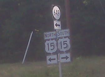
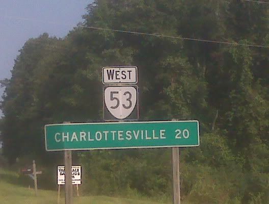
Virginia Primary Route
Bicycle Route
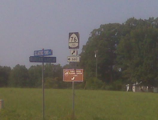
Virginia Secondary Route - The large sign with the route number in the circle seems to be reserved for more heavily traveled secondary routes. The small rectangular sign is the VDOT standard signage for secondary routes according to VDOT map legends. To further confuse, I even saw US 15 labeled (at some intersections with secondary roads) with the small rectangular sign.
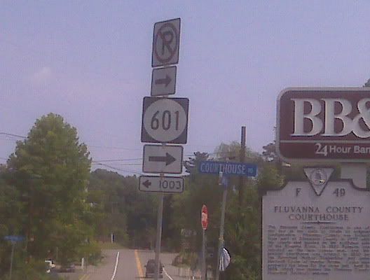
The route number is more important than the sign. My understanding is, if the number is 600 or higher, it is a secondary road and the number can and will be repeated from place to place. If the number is less than 600, it is a primary route and the number will only be used for that particular road.
Re: VA Maps, sign logic
Posted: Mon Aug 03, 2009 5:49 pm
by TinMan
Thanks for the explaination! I've noticed already the minor roads on the state map don't always line up with the physical road..
On the 600 and above being used else where, MO does that too with county and secondary state roads.. In MO they use letters (either single as in A or double as in PP). The double letters tend to (but not always go between counties where the single letters are in county roads... Of course, they'll use the same letters in other counties for roads that go different directions.. major state roads in MO use numbers that can carry across the state.
Road Trolls at work I guess..
Re: VA Maps, sign logic
Posted: Wed Aug 05, 2009 9:59 am
by bowr1200rt
http://shop.delorme.com/OA_HTML/DELibeC ... phtV%253AS~
You can also pick these maps up at most any Walmart. Great maps with great detail.
Re: VA Maps, sign logic
Posted: Tue Aug 25, 2009 12:22 pm
by MikeS
If you are ever looking for a Route Number but the internet only lists the road name, use this free top map site to zoom in on the road then switch to TOPO view to see its road number. Also a great free easy way to view topo maps for free and in a google map client.
 http://www.digital-topo-maps.com/